

Urban Flood
- Aug 6, 2014
- 2 min read
By Katera Y. Moore, PhD
A watershed is all the land that is drained by single body of water (land surface drains into small streams, stream merge into tributaries, and tributaries form rivers). In the natural hydrologic cycle, processes such as evaporation, condensation, precipitation, deposition, runoff, infiltration, sublimation, transpiration, melting, and groundwater flow cycle and filter water through the atmosphere, biosphere and hydrosphere. Runoff follows the gradient of the landscape as water seeks its way to the river.
In urban areas, these processes are compromised by development. Topography is altered thus surfaces that would normally act as filters or buffers are paved over thus causing more water to runoff and carry with it pollutants from human activity.
Runoff can contribute to both water pollution and flooding. FEMA defines as “a general and temporary condition of partial or complete inundation of two or more acres of normally dry land area or of two or more properties from overflow of inland or tidal waters or from the unusual and rapid accumulation or runoff of surface waters from any source.” Flooding typically results from shallow-rivers overflowing their banks, flash flooding caused by heavy downpours, and coastal flooding often caused by hurricanes and tidal surges.
The intensity of flooding due to a heavy rain event is determined by the amount and distribution of precipitation in the watershed, the rate at which the precipitation soaks into the landscape, how quickly surface runoff reaches the river, and the amount of moisture in the soil.
Flooding can be devastating to humans – flood waters carry pollution and disease and can render homes unoccupable. Land use on floodplain (flat surface adjacent to channel), effectiveness of forecasting, warning, and evacuation, depth and velocity of floodwaters, rate of rise and duration of flooding, season can contribute to flooding probability. Urbanization increases the magnitude and frequency of floods because of impervious cover and unintentional alterations to stream channels. FEMA manages the US National Flood Insurance Program using maps o the 100-year floodplain to determine where there is a 1% chance of an area being submerged by a flood in a 100-year period.
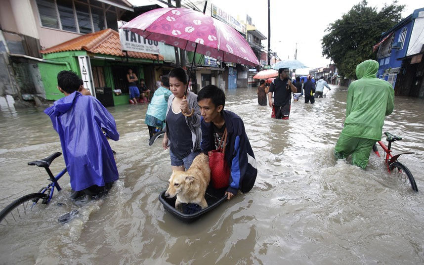
After hurricanes, flood losses are the largest of all natural hazards in the United States. It is likely that global warming will increase extreme precipitation and intensify flooding; however, the risk is not equally distributed. Urbanization further increases flood risk and the uncertainty of what is to come makes it prudent to reduce the vulnerability of potential victims. The tragic aftermath of Hurricane Katrina in 2005 illustrates the potential tragic impacts of inadequate planning and response to vulnerable populations. More recently, communities along the Atlantic coast are finally rebounding from the devastation caused by Hurricane Sandy in 2012. The change in the landscape coupled with the actual and potential results of global climate change has increased the amount of marginal communities at risk for natural hazards, particularly those related to flooding.


Comments